Antarctic Blast to Bring Snow to Australian Capitals
Frigid polar air is forecast to deliver snow flurries to hills surrounding Melbourne, Hobart, and Canberra, marking the coldest day of the year.

AUSTRALIA —
Key facts
- Snow is forecast for hills around Melbourne, Hobart, and Canberra on Wednesday night and Thursday morning.
- Thursday is expected to be the coldest day of the year so far for much of Australia.
- Snow flurries are possible down to 500 metres in Tasmania.
- Snowfall is expected down to 600 metres in Victoria and 700-900 metres in NSW and the ACT.
- Ski resorts could receive five to 10 centimetres of snow.
- Daytime temperatures across the southeast are expected to be 4-8 degrees Celsius colder.
- The cold snap follows a period of unseasonably warm autumn weather.
Polar Air Triggers Wintry Mix Across Southeast
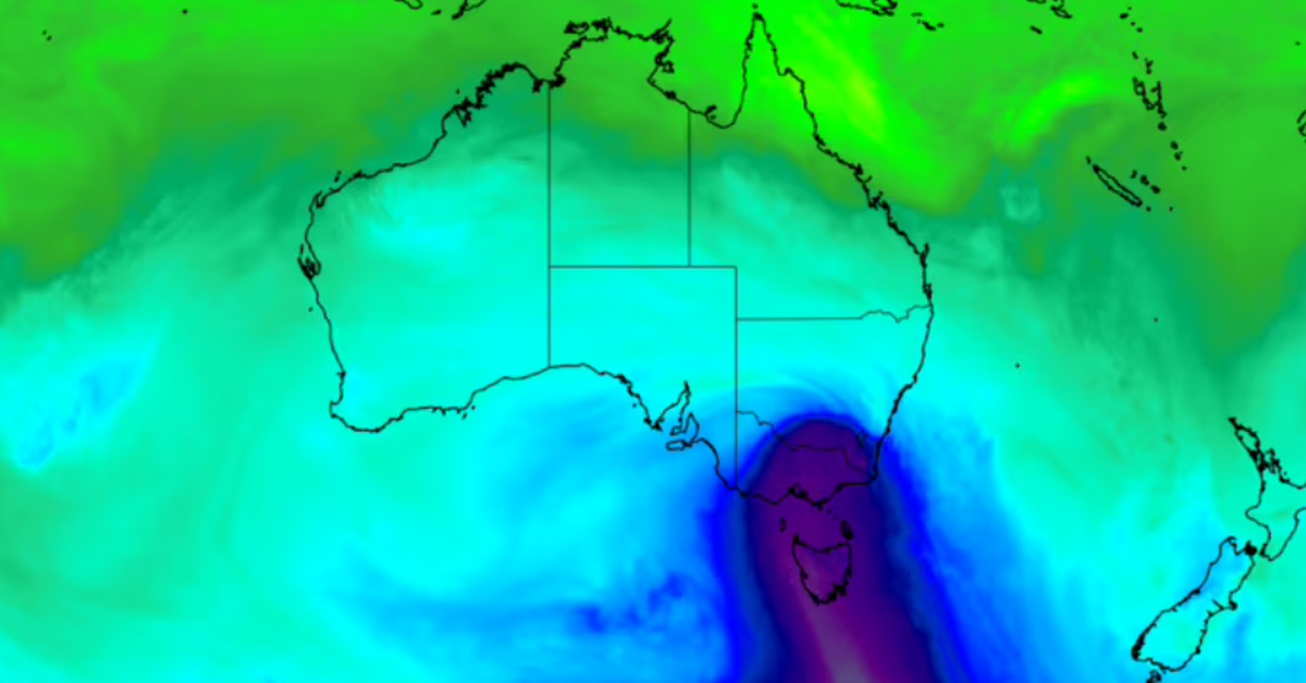
A significant blast of Antarctic air is sweeping across Australia's southeast, bringing a sharp end to recent warm autumn weather. Frigid polar conditions are forecast to deliver snow flurries to elevated terrains surrounding major capitals, with Thursday anticipated to be the coldest day of the year for many. The cold front, extending back to near Antarctica, is set to move through South Australia, Victoria, and Tasmania from Wednesday afternoon into Thursday. This system will usher in a brief but intense period of wintry conditions, including rain, small hail, and brisk winds, before pushing out to the Tasman Sea.
Snowfall Expected at Lower Altitudes
The Bureau of Meteorology forecasts snow down to 500 metres in Tasmania, 600 metres in Victoria, and 700 to 900 metres in New South Wales and the Australian Capital Territory. While ski resorts could receive between five to 10 centimetres of snow, other areas might experience flurries that are unlikely to settle on the ground overnight. These lower snowfall levels represent the season's lowest for many, though totals are not expected to be as substantial as some earlier predictions. The cold air mass behind the front will cause daytime temperatures to plunge by 4 to 8 degrees Celsius across the region.
Capitals Brace for Sharp Temperature Drop
Hills surrounding Melbourne, Hobart, and Canberra are most likely to witness these snow flurries. For Melbourne and Canberra, Thursday is predicted to be the coldest day of the year so far, with the latter expecting a maximum temperature of just 12 degrees Celsius. Sydney will also experience a significant chill, with a forecast top of 19 degrees. Bureau forecaster Jonathan How described the rapid change as a "short, sharp shock" for many who had become accustomed to a recent spell of warm late-autumn weather. This abrupt shift in conditions follows a period where temperatures across northern South Australia and southern Tasmania had soared more than 10 degrees Celsius above May averages, shattering previous records.
Widespread Wintry Conditions and Cold Winds
Beyond the potential for snow, the cold front will bring rain and showers to parts of South Australia, southern Victoria, and Tasmania, accompanied by the possibility of small hail. Cold winds will also be a feature of the weather system. In contrast, central Australia will remain dry but cold. Adelaide is forecast for a top of 17 degrees Celsius, while Alice Springs can expect frost. A high-pressure system over the Great Australian Bight is deflecting rainfall away from Central Australia.
A Stark Contrast to Recent Warmth
The timing of this polar blast is particularly notable, arriving just days after parts of the country experienced record-breaking warmth for May. This unseasonable heat had led many to acclimatise to milder conditions, making the impending cold snap a significant meteorological event. The swift transition underscores the dynamic nature of Australian weather patterns, where dramatic shifts can occur rapidly. The Bureau of Meteorology's forecast highlights the extensive reach of this cold front, impacting multiple states with distinct but equally chilly conditions.
The bottom line
- A significant Antarctic air mass is causing a sharp drop in temperatures across Australia's southeast.
- Snowfall is expected on hills surrounding Melbourne, Hobart, and Canberra from Wednesday night into Thursday.
- Thursday is forecast to be the coldest day of the year for many Australian cities, including Melbourne and Canberra.
- The cold snap follows a period of unseasonably warm weather that broke May temperature records in several states.
- While ski resorts may see several centimetres of snow, lower-altitude flurries are unlikely to accumulate.
- Rain, small hail, and cold winds will accompany the snow across affected regions.


Arctic Blast Plunges Millions into Deep Freeze as May Cold Front Shatters Spring Warmth
