Kamchatka megaquake reveals tsunami risks and reshapes wave science
The magnitude 8.8 earthquake on July 29, 2025, the sixth-largest ever recorded, has yielded unprecedented satellite data that challenges long-held assumptions about tsunami behavior.

CANADA —
Key facts
- A magnitude 8.8 earthquake struck the Kuril-Kamchatka subduction zone on July 29, 2025.
- The earthquake is the sixth-largest recorded by modern instruments since 1900.
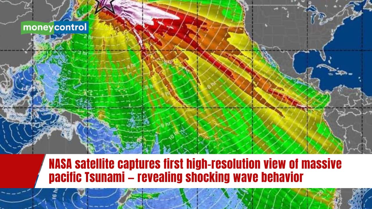
- NASA's SWOT satellite captured the first high-resolution, wide-swath image of a tsunami in motion.
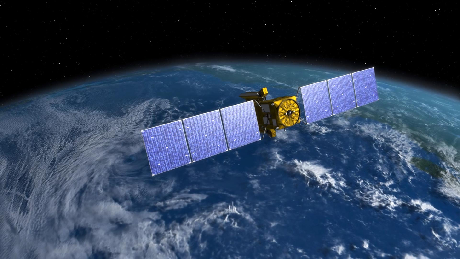
- SWOT, launched in December 2022, is a joint NASA-CNES mission to map Earth's surface water.
- Researchers combined SWOT data with readings from DART buoys to analyze the tsunami's propagation.
- The rupture extended approximately 400 kilometers, longer than the 300 kilometers estimated by earlier models.
- The tsunami displayed dispersive wave behavior, contradicting the traditional assumption that large tsunamis are non-dispersive.
- Tohoku University's IRIDeS team found that seafloor movement during the quake was more limited than expected, resulting in a smaller tsunami than early forecasts.
A seismic giant and a scientific windfall
On July 29, 2025, a magnitude 8.8 earthquake erupted near Russia’s Kamchatka Peninsula, registering as the sixth-largest earthquake ever recorded by modern instruments. The quake, which occurred in the Kuril-Kamchatka subduction zone, unleashed a tsunami that spread across the Pacific Ocean. For scientists, the event was not just a disaster but an unprecedented opportunity: it was the first giant earthquake in the region to be observed in detail by modern satellites. Researchers at Tohoku University’s International Research Institute of Disaster Science (IRIDeS) quickly mobilized, combining satellite radar imagery and GPS data to reconstruct the fault movement. Their analysis, published in Geoscience Letters, aims to improve understanding of tsunami risks for local communities. “The Kamchatka Peninsula is one of the most tectonically active plate boundaries in the world, known as a subduction zone,” said Chi-Hsien Tang of IRIDeS. “This subduction zone produces some of the largest earthquakes on Earth, such as the magnitude 9.0 earthquake in 1952.”
SWOT’s eye on the ocean: a new view of tsunami dynamics
The NASA-CNES Surface Water and Ocean Topography (SWOT) satellite, launched in December 2022, was designed to map Earth’s surface water on a global scale. When the Kamchatka tsunami struck, SWOT captured the first high-resolution, wide-track image of a major tsunami in motion. Unlike previous satellites that could only record narrow slices of data, SWOT observed a swath up to 120 kilometers wide, providing unprecedented detail. “I think of SWOT data as a new pair of glasses,” said Angel Ruiz-Angulo of the University of Iceland, lead author of a study in The Seismic Record. “Before, with DARTs we could only see the tsunami at specific points in the vastness of the ocean. There have been other satellites before, but they only see a thin line across a tsunami in the best-case scenario. Now, with SWOT, we can capture a swath up to about 120 kilometers wide, with unprecedented high-resolution data of the sea surface.” Ruiz-Angulo and co-author Charly de Marez had spent over two years analyzing SWOT data for ocean features like small eddies, never expecting to capture a tsunami.
Challenging the non-dispersive dogma
Scientists have long assumed that very large tsunamis behave as non-dispersive waves, traveling largely intact as a single wave because their wavelengths exceed ocean depth. The SWOT data for the Kamchatka event has overturned that assumption. The satellite observations showed clear evidence of dispersion, where wave energy spreads into multiple components. “The SWOT data for this event has challenged the idea of big tsunamis being non-dispersive,” Ruiz-Angulo explained. Computer simulations that incorporated dispersive behavior matched real-world data more closely than traditional models. “The main impact that this observation has for tsunami modelers is that we are missing something in the models we used to run,” he added. “This ‘extra’ variability could represent that the main wave could be modulated by the trailing waves as it approaches some coast. We would need to quantify this excess of dispersive energy and evaluate if it has an impact that was not considered before.”
Reconstructing the rupture: a longer, shallower fault
The IRIDeS team built three slip models simulating the Kamchatka earthquake and compared them to actual tsunami records. Their results suggest that although the earthquake was large, the amount of movement near the seafloor was more limited than expected. Since seafloor movement is critical for tsunami generation, this explains why the resulting tsunami was smaller than early forecasts. “It was so rewarding to see that our analysis consistently matched up with actual observational records,” said Tang. Meanwhile, Ruiz-Angulo’s team used DART buoy data in an inversion approach to refine the earthquake source. Their updated analysis indicates the rupture extended farther south than previously believed and stretched about 400 kilometers — significantly longer than the 300 kilometers estimated by earlier models. This longer rupture helps explain discrepancies in tsunami arrival times at monitoring sites.
Unruptured zones and future tsunami hazards
The IRIDeS findings also highlight lingering risks. The unruptured portions of the fault surrounding the slip zone may move in future earthquakes, with areas north of the rupture zone and the shallow portion of the fault carrying higher tsunami potential. This underscores the need for continued monitoring. The research also demonstrates that land-based data alone is insufficient to fully capture offshore earthquake behavior. “Accurate modeling and reconstruction of giant earthquakes such as these is expected to help with predicting the risk of dangerous tsunamis,” the Tohoku team noted. The combination of satellite and seafloor observations is crucial for improving forecasts.
Implications for tsunami forecasting and coastal safety
The discovery that tsunamis can exhibit dispersive behavior has direct implications for forecasting. Traditional models that assume non-dispersive waves may underestimate the complexity of wave interactions near coastlines. The new data suggests that trailing waves can modulate the main wave, potentially altering its impact. Ruiz-Angulo emphasized the need to incorporate this dispersive energy into operational models. “We would need to quantify this excess of dispersive energy and evaluate if it has an impact that was not considered before,” he said. The SWOT satellite, originally built for hydrology, has proven its value for oceanography and disaster science, offering a new tool for protecting coastal communities worldwide.
The bottom line
- The July 29, 2025 Kamchatka earthquake (M8.8) is the sixth-largest ever recorded and the first in the region observed in detail by modern satellites.
- SWOT satellite data revealed that large tsunamis can be dispersive, overturning the long-held non-dispersive assumption and improving model accuracy.
- The earthquake rupture extended about 400 km, longer than earlier estimates, and involved limited shallow slip, resulting in a smaller-than-expected tsunami.
- Unruptured fault segments north of the slip zone and at shallow depths pose future tsunami risks.
- Combining satellite, GPS, and seafloor buoy data is essential for accurate tsunami forecasting and coastal hazard assessment.


Flyers and Hurricanes Set for First Postseason Meeting After Four Overtime Thrillers

Oil prices surge past $126 before retreating as Iran and U.S. harden stances on Strait of Hormuz

Late-Season Snow to Hit Colorado Rockies but Will Not Break Record Drought