UK Braces for Dramatic Temperature Swing: From 25°C Highs to Widespread Frost and -5°C Lows
After an unseasonably warm spell that saw thermometers hit 25°C, Britain faces a midweek Arctic chill with temperatures plunging by up to ten degrees and frost settling across Scotland and northern England.
UNITED KINGDOM —
Key facts
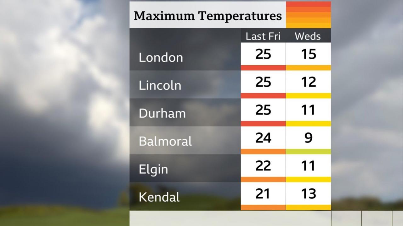
- Temperatures peaked at 25°C (77°F) in parts of England on Friday, April 28.
- Midweek highs will drop to 7-8°C in the north and 15°C in the south, a roughly 10°C fall.
- Overnight Wednesday, temperatures could fall to -4°C in eastern Scotland and -1°C in northern England.
- Widespread frost is expected across Scotland, with lows of -5°C in rural glens of Caithness, Sutherland, and the north-west Highlands.
- Monday night saw 0.6°C in Lerwick, Shetland.
- The cold snap is driven by a northerly airflow from the Arctic, as a high-pressure system over the Atlantic directs cold air south.
- By Thursday, wind direction shifts to south-southwesterly, bringing milder air and a recovery in temperatures.
A Sudden Chill After Spring Warmth
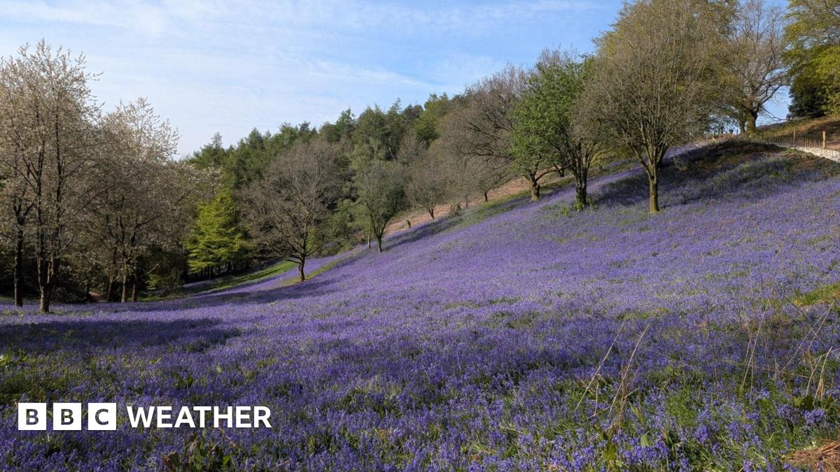
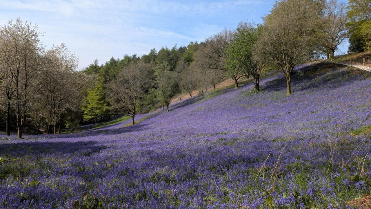
Britain’s weather has performed a sharp U-turn. After basking in 25°C heat on Friday, the first full week of May has ushered in a dramatic cool-down, with temperatures set to tumble by as much as ten degrees in some areas. The shift, while abrupt, returns the country to near-normal early-May averages of around 12°C in the north and 15°C in the south. For those who had grown accustomed to the balmy conditions of the past two weeks, the change will feel particularly stark. The contrast is heightened by the fact that last week’s warmth was exceptional for the season, rather than the current cooler values being unusually low.
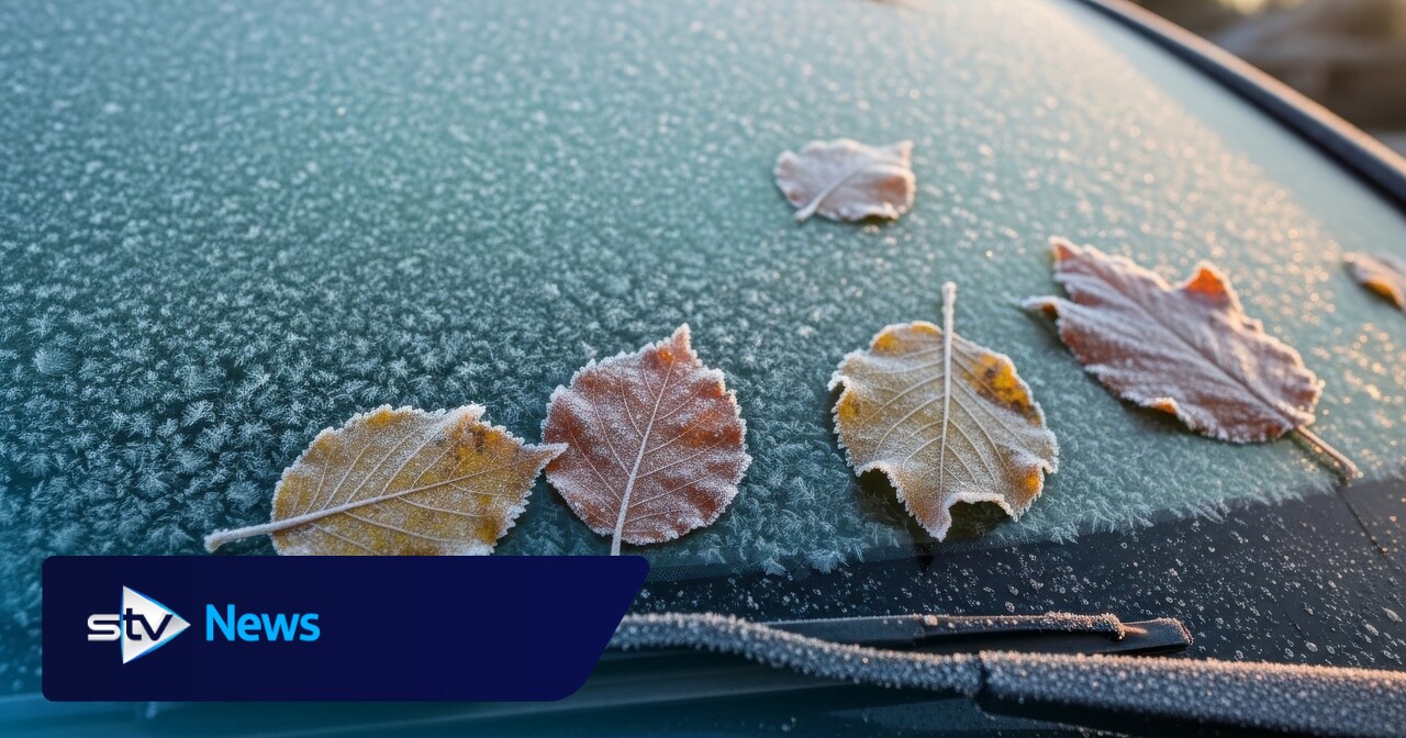
Midweek Arctic Plunge: Frost and Freezing Nights
The most severe cold is expected midweek. Wednesday is forecast to be the coolest day, as a gentle northerly flow takes hold. Overnight temperatures could plunge to -4°C across eastern Scotland and -1°C in northern England, with a widespread frost. In rural glens of Caithness, Sutherland, and the north-west Highlands, the mercury may dip to -5°C. Monday night already saw 0.6°C in Lerwick, Shetland, but Wednesday night is expected to be the coldest of the week. The cold air, originating from the Arctic, is being drawn south by a large high-pressure system over the Atlantic. This “Arctic plunge,” as some tabloids have termed it, is simply the result of a northerly wind direction bringing colder air from higher latitudes.
Showery Days and Frosty Mornings Across the UK
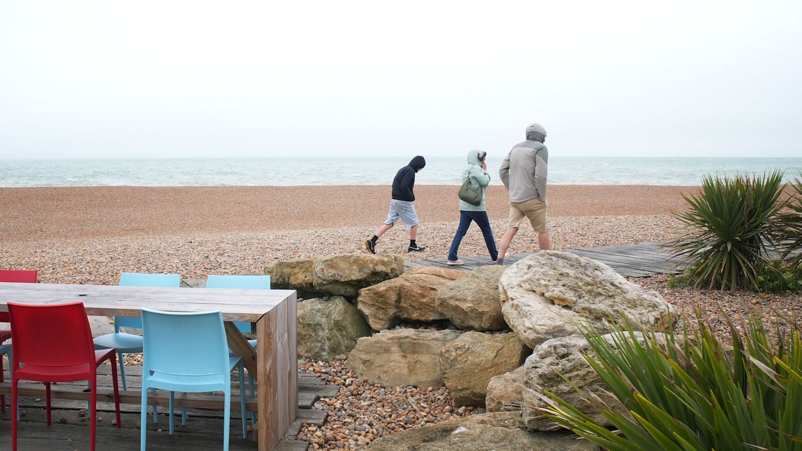
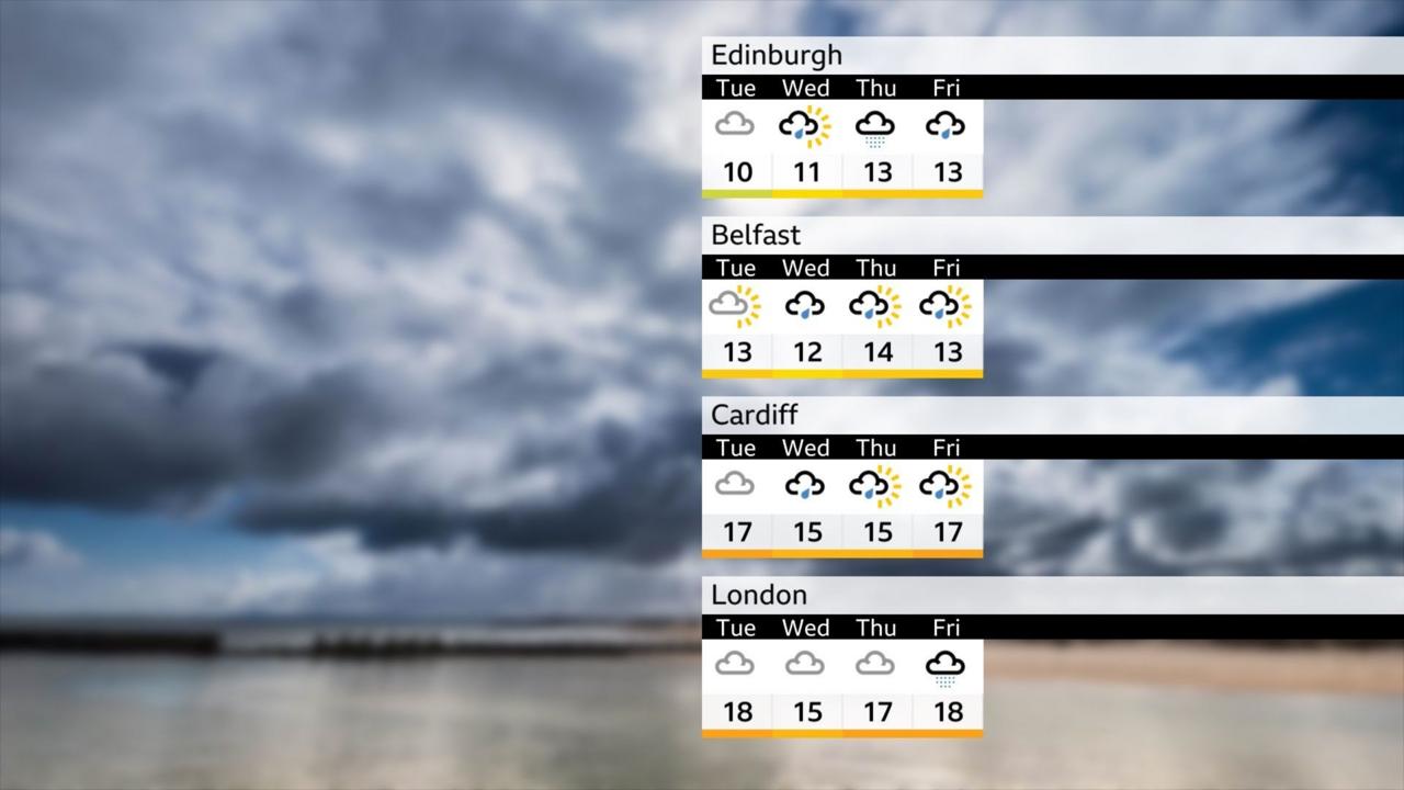
The week will be characterised by a mix of sunny spells and scattered showers. Tuesday began on a chilly note, with early fog clearing to leave sunshine but also showers, most frequent across Scotland, northern England, the Midlands, and Wales. Wednesday will see patchy ground frost more widespread, with occasional slow-moving downpours. By Thursday, a milder southwesterly wind will return, bringing steady rain to Scotland and showery bursts elsewhere. The shift in wind direction will mark the beginning of a temperature recovery, though the weather remains unsettled and changeable. Early ground frost and pockets of fog are expected to return, particularly overnight, but at this time of year they are short-lived.
Regional Breakdown: Scotland Bears the Brunt
Scotland faces the most extreme conditions. The northerly airflow has placed the country in a persistent chill, with temperatures on Tuesday and Wednesday feeling significantly colder than recent weeks. Widespread frost is expected, especially in rural areas, where clear skies and light winds allow temperatures to plummet. In the far north, a passing weather front brought rain on Monday, while over the highest Munros, lingering showers may fall as snow. Northern but will see mostly dry conditions with warm sunny spells. England and Wales will experience cloudier skies, with the best of the sunshine in the north, while southern areas face a greater chance of lively showers and even isolated thunder.
What the Temperature Swing Means for the Public
The dramatic drop from 25°C to single-digit highs in just a few days is both noticeable and rapid. For gardeners, the return of ground frost poses a risk to delicate plants that may have been put out during the warm spell. The frost, while not unheard of in early May, is less usual at this point in the season. The change in wind direction is the key driver: a northerly wind brings cold Arctic air, while a southerly wind would tap into warm tropical air from North Africa or southern Europe. An easterly wind’s effect depends on the season—bitterly cold in winter, but potentially warm and dry in summer. This week, the northerly flow is the culprit.
Outlook: A Gradual Return to Milder Conditions
The cold snap is expected to be short-lived. By Thursday, the wind direction will shift to a south-southwesterly flow, allowing temperatures to recover and bringing milder conditions. However, the general weather pattern remains unsettled, with further showers and changeable conditions likely. While the midweek chill will feel harsh compared to last week’s warmth, it is a return to seasonal norms. The real story is the contrast: a ten-degree swing in a matter of days, serving as a reminder of Britain’s famously fickle spring weather.
The bottom line
- Temperatures will drop by up to 10°C from last week’s highs, with midweek values of 7-8°C in the north and 15°C in the south.
- Overnight lows could reach -5°C in parts of Scotland, bringing widespread frost and a risk to plants.
- The cold air is driven by a northerly airflow from the Arctic, not an unusual weather phenomenon.
- The cold snap is brief: by Thursday, a south-southwesterly wind will bring milder air and a temperature recovery.
- Despite the dramatic swing, the current temperatures are near the early-May average; last week’s warmth was exceptional.
- The unsettled pattern continues, with showers and changeable conditions expected through the rest of the week.

In 'The Cage,' a Casino Heist Becomes a Devastating State-of-the-Nation Drama

Jill Halfpenny and Sally Lindsay Star in Channel 5's 'Number One Fan', a Stalker Thriller with Unexpected Twists
Neil Patrick Harris Stars in 'The Last Temptation of Becky' as Threequel Unveiled
