Hong Kong Braces for 9-Degree Temperature Drop and Thunderstorms as Cold Front Approaches
The Hong Kong Observatory warns of intense thundery showers, squally gusts, and a sharp temperature decline as a cold front and upper-air disturbances sweep across the region.
HONG KONG —
Key facts
- A cold front is expected to cross Hong Kong on Wednesday, bringing a 9-degree temperature drop.
- The Hong Kong Observatory issued an amber rainstorm warning as thunderstorms hit the city.
- on Hong Kong's outlying islands after the amber rainstorm warning was cancelled.
- The Probability of Significant Rain (PSR) forecast indicates up to 10 mm of accumulated rainfall on affected days.
- Forecast accuracy for the next 1-3 days is about 90%, dropping to 80% for days 8-9.
- Upper-air disturbances will ease off over the coast of southern China by midweek.
- Residents in low-lying and poorly drained areas are warned of possible flooding.
Sharp Weather Shift on the Horizon
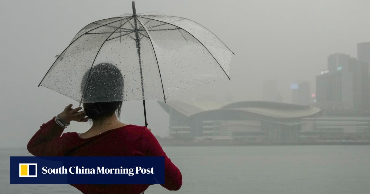
Hong Kong is set for a dramatic change in weather this week as a cold front and upper-air disturbances bring heavy rains, thunderstorms, and a 9-degree temperature drop. The Hong Kong Observatory has warned residents to brace for intense thundery showers and squally gusts, particularly on Wednesday when the front crosses coastal areas. The trough of low pressure over northern part of southern China is expected to develop into a cold front by Wednesday, moving across the Pearl River Delta region. The Observatory advises anyone outdoors to seek safe shelter as soon as possible, as intense gusts could affect the city.
Thunderstorms and Hail Hit the City
On Sunday, a cold front approached Hong Kong, bringing thunderstorms and prompting the Observatory to issue an amber rainstorm warning. The warning was later cancelled, but hail was reported on Hong Kong's outlying islands, an unusual phenomenon for the region. The unstable weather is expected to continue with heavy showers on Wednesday as temperatures drop. The Observatory warned that flooding could occur in some low-lying and poorly drained areas, urging residents to take precautions.
Forecast Accuracy and Probability of Significant Rain
The Observatory's 9-day weather forecast provides general indications of trends, with the Probability of Significant Rain (PSR) offering additional reference on rainfall amounts. The PSR indicates the probability of accumulated rainfall reaching 10 mm or more on a given day, categorized into five levels. Forecast accuracy is highest for the next 1-3 days at about 90%, decreasing to 85% for days 4-7 and 80% for days 8-9. For PSR, errors are within 10% for the next 1-6 days and within 20% for days 7-9. spring and summer weather, including fog, tropical cyclones, and severe convective weather, is more changeable, increasing forecast uncertainty.
Midweek Relief Expected as Upper-Air Disturbances Depart
The Observatory stated that showers are expected to ease off over the coast of southern China by midweek as upper-air disturbances depart. However, before that, residents should expect cloudy skies, occasional showers, and a few squally thunderstorms. The cold front will bring a sharp temperature drop, with the mercury falling by up to 9 degrees Celsius. The weather will remain cloudy with occasional showers and a few squally thunderstorms, but conditions are expected to stabilize later in the week.
Climate Change and Extreme Weather in Hong Kong
Hong Kong has experienced an increase in extreme weather events in recent years, including typhoons, black rain alerts, and heatwaves. The city's subtropical climate makes it vulnerable to sudden weather shifts, and the Observatory has faced calls to better explain typhoon warning decisions. While the current cold front is a seasonal phenomenon, the intensity and frequency of such events are influenced by broader climate patterns. The Observatory's data, based on 30-year climatological records from 1991 to 2020, provides a baseline for understanding these changes.
What Comes Next: Monitoring and Preparedness
Residents are advised to stay updated with the Observatory's forecasts and warnings, especially as the cold front approaches. The PSR and 9-day forecast will continue to be updated, providing guidance on rainfall and temperature trends. The Observatory emphasizes that forecast accuracy decreases with time, so long-range predictions should be treated with caution. As the city braces for the weather shift, authorities are on alert for potential flooding and disruptions.
The bottom line
- A cold front will bring a 9-degree temperature drop and thunderstorms to Hong Kong on Wednesday.
- The Hong Kong Observatory issued an amber rainstorm warning, and hail was reported on outlying islands.
- Forecast accuracy is highest for the next 1-3 days (90%) and decreases to 80% for days 8-9.
- Upper-air disturbances will ease by midweek, but heavy showers and flooding risks persist.
- Climate change may be contributing to more extreme weather patterns in Hong Kong.


Hong Kong Braces for Thunderstorms as Cold Front Brings Temperatures Down to 21°C

Coleman Wong overcomes Bu Yunchaokete to set up Jiujiang semi-final against Sun Fajing

張天賦七月重返紅館 「E = mc²」個唱演繹雙重人格
