Georgia Wildfires Destroy Over 120 Homes, Most in State History
Two human-caused blazes, fueled by drought and Hurricane Helene debris, have burned more than 50,000 acres and are still only partially contained.
INDIA —
Key facts
- Two wildfires in southern Georgia have burned over 50,000 acres as of April 28, 2026.
- The Highway 82 fire started on April 18 from a welding spark; the Pineland Road fire ignited on April 21 after a mylar balloon hit power lines.
- More than 120 homes have been destroyed, the highest number lost to wildfire in Georgia history.
- Extreme drought conditions across the U.S. Southeast have persisted for months, fueling the blazes.
- Hurricane Helene's fallen trees and limbs from September 2024 have provided additional fuel.
- As of April 28, the Pineland Road fire was 23% contained and the Highway 82 fire 32% contained.
- Hundreds of firefighters are battling the fires with air and ground equipment.
A Record-Breaking Firestorm in Southern Georgia
Two wildfires raging in southern Georgia have destroyed more than 120 homes, marking the highest number of residential structures lost to wildfire in the state's history. The blazes, dubbed the Pineland Road and Highway 82 fires, have together scorched over 50,000 acres (20,000 hectares) as of April 28, according to the Georgia Forestry Commission. The fires erupted in a region already crippled by extreme drought that has gripped the U.S. Southeast for months. Parched conditions, combined with blustery winds, allowed the flames to spread rapidly through forests and residential areas in Brantley and Clinch counties.
Two Human-Caused Ignitions, Days Apart
The Highway 82 fire began on April 18 when a spark from a welding operation ignited dry vegetation. Three days later, on April 21, the Pineland Road fire was sparked by a mylar balloon colliding with power lines. Both incidents were human-caused, forestry officials confirmed. Fallen trees and limbs left by Hurricane Helene in September 2024 have provided abundant fuel for the fires, exacerbating their intensity and spread. The hurricane's debris, scattered across the landscape, has turned the region into a tinderbox.
Hundreds of Firefighters Deployed, Partial Containment Achieved
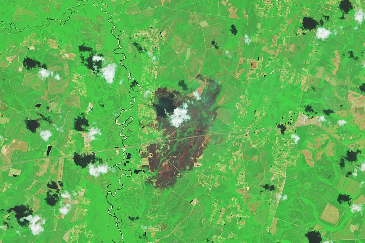
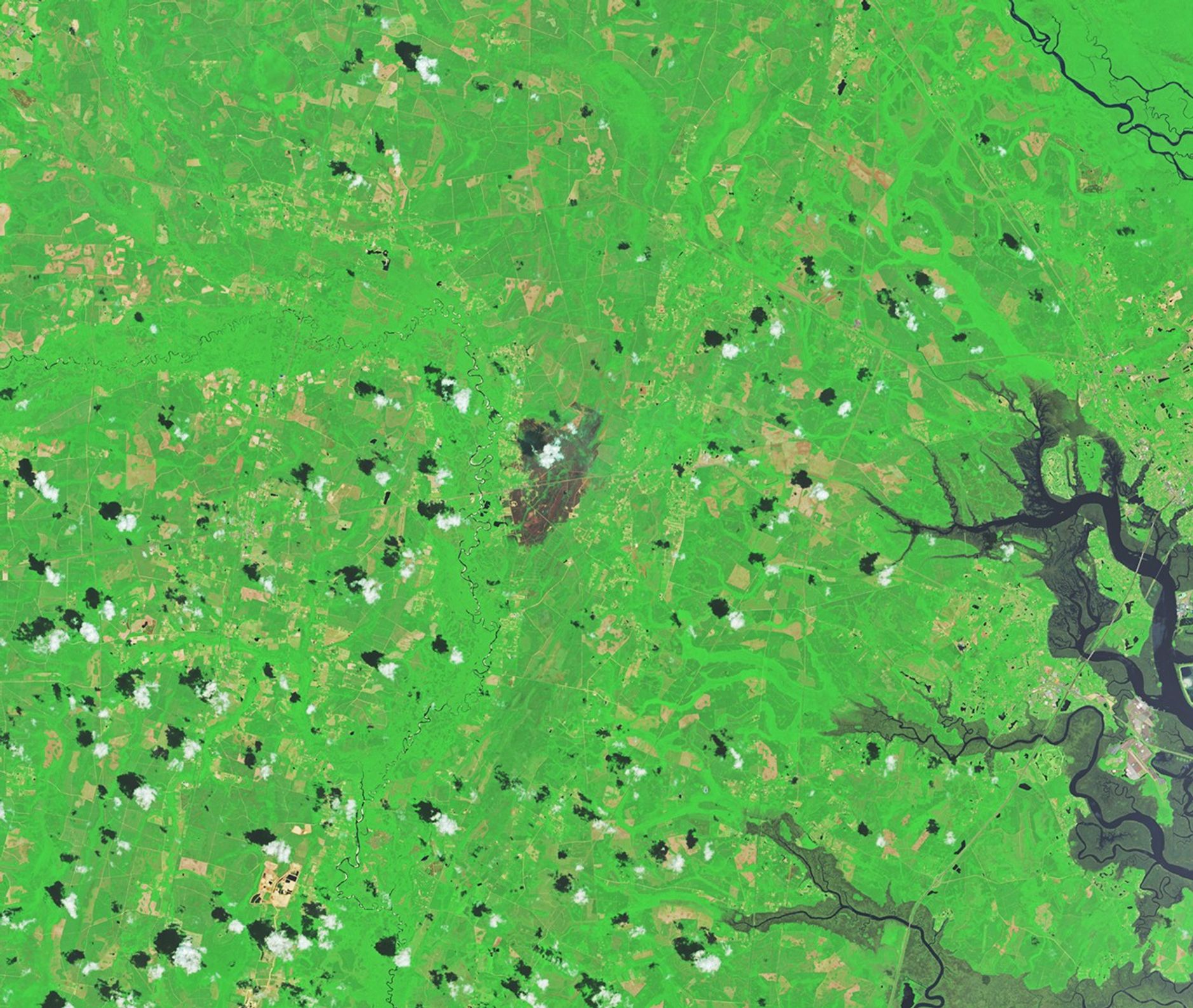
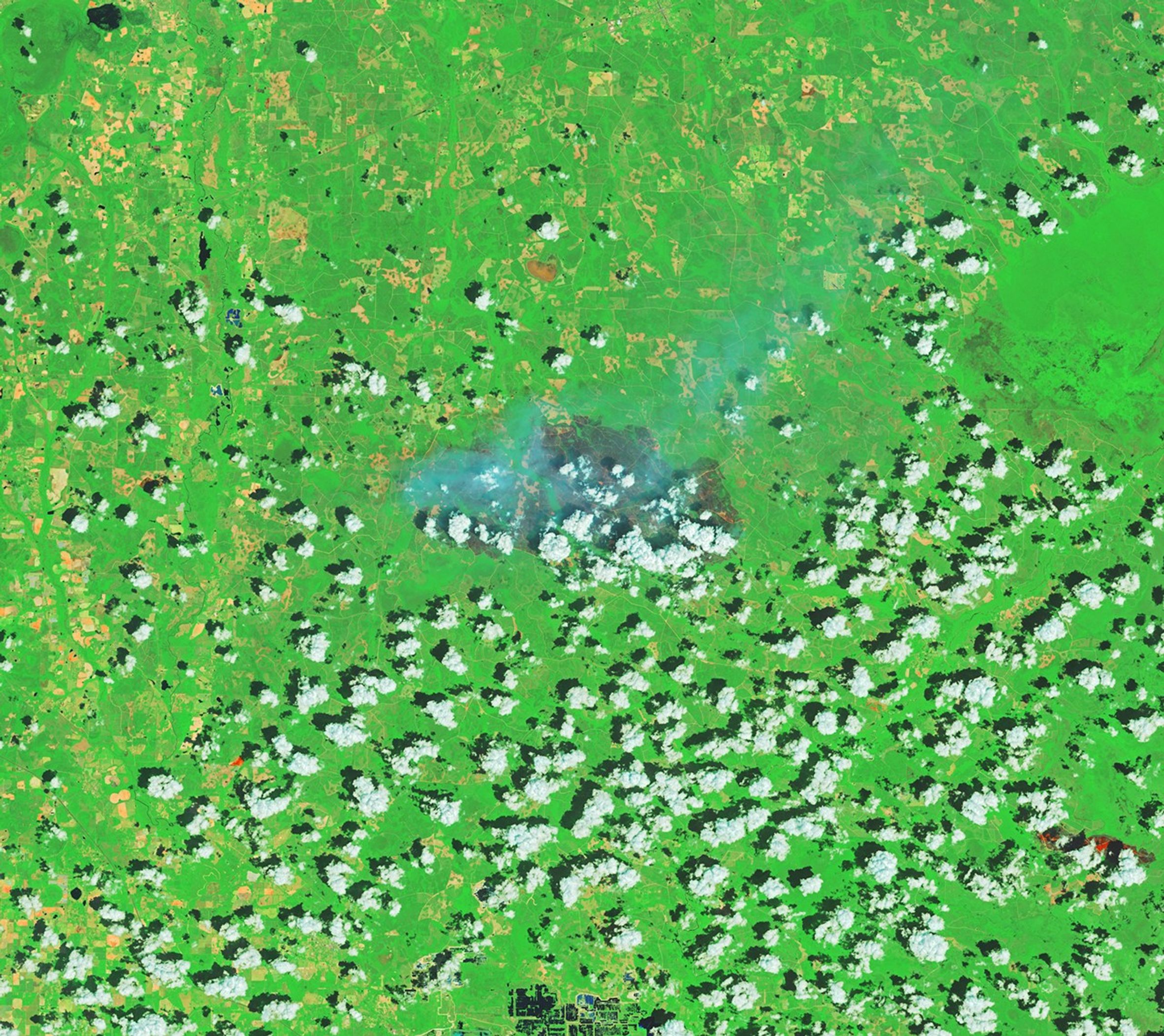
Hundreds of firefighting personnel are confronting the blazes with equipment both in the air and on the ground. Heavy rains in recent days have aided their efforts, but containment remains limited. As of April 28, the Pineland Road fire was only 23 percent contained, while the Highway 82 fire was 32 percent contained, the Georgia Forestry Commission reported. Satellite images captured by Landsat 8 on April 23 show charred forests and residential areas near Atkinson and Fruitland. The false-color imagery (bands 7-5-4) reveals burned areas in gray and active fire fronts in orange, highlighting the scale of destruction.
NASA's Role in Monitoring and Analysis
NASA's satellite and aircraft data are part of a global observation system used to track fire behavior, analyze emerging trends, and develop technology for wildfire management. Among the real-time monitoring tools NASA provides are FIRMS (Fire Information for Resource Management System), the Worldview browser, and the Fire Event Explorer. These tools allow operational agencies to access critical information during emergencies. The NASA Earth Observatory images were created by Michala Garrison using Landsat data from the U.S. Geological Survey.
Drought and Hurricane Legacy Fuel the Crisis
The extreme drought that has parched the Southeast for months is a key factor in the fires' severity. Limited rainfall has left vegetation dry and highly flammable. The additional fuel from Hurricane Helene's debris has compounded the problem, creating conditions that forestry officials describe as unprecedented. The fires have already set a grim record for homes lost in Georgia, surpassing previous wildfire disasters. The combination of drought, wind, and hurricane debris has created a perfect storm for destructive blazes.
Outlook: Continued Firefighting Efforts and Lingering Risks
While heavy rains have provided some relief, the fires remain far from fully contained. Firefighters continue to battle the blazes, focusing on protecting remaining structures and preventing further spread. The Georgia Forestry Commission has not yet provided a timeline for full containment. The long-term outlook depends on weather patterns and the ability to control the fire lines. With drought conditions persisting, the risk of additional ignitions remains high. The fires serve as a stark reminder of the compounding effects of climate extremes and legacy disasters.
The bottom line
- Two human-caused wildfires in southern Georgia have destroyed over 120 homes, a state record.
- The fires have burned more than 50,000 acres and are only partially contained as of April 28.
- Extreme drought and debris from Hurricane Helene have fueled the blazes.
- Hundreds of firefighters are deployed with air and ground support.
- NASA's satellite data and tools are aiding real-time monitoring and analysis.
- Full containment is not yet in sight, with drought conditions expected to persist.


Bhuvneshwar Kumar's Meerut bungalow: A ₹70–75 crore symbol of a swing king's journey

Today's Chanakya Exit Poll Predicts Mamata Banerjee's Defeat in West Bengal, Tight Race in Kerala

Nagaland State Lottery: A ₹1 Crore Daily Draw That Fuels a State Economy