Two Low-Pressure Areas Loom East of Philippines, One May Become Tropical Depression Ada
The systems, with a medium chance of intensifying within 24 hours, are already enhancing the southwest monsoon, triggering flood preparations in Quezon City.
PHILIPPINES —
Key facts
- Two LPAs are inside the Philippine Area of Responsibility as of Monday.
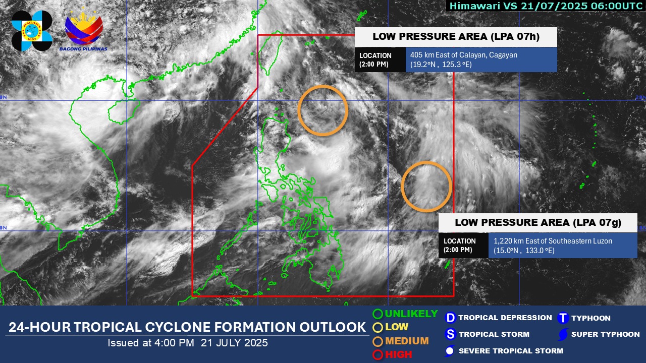
- First LPA located 1,220 km east of Southeastern Luzon at 3 p.m. Monday.
- Second LPA located 405 km east of Calayan, Cagayan.
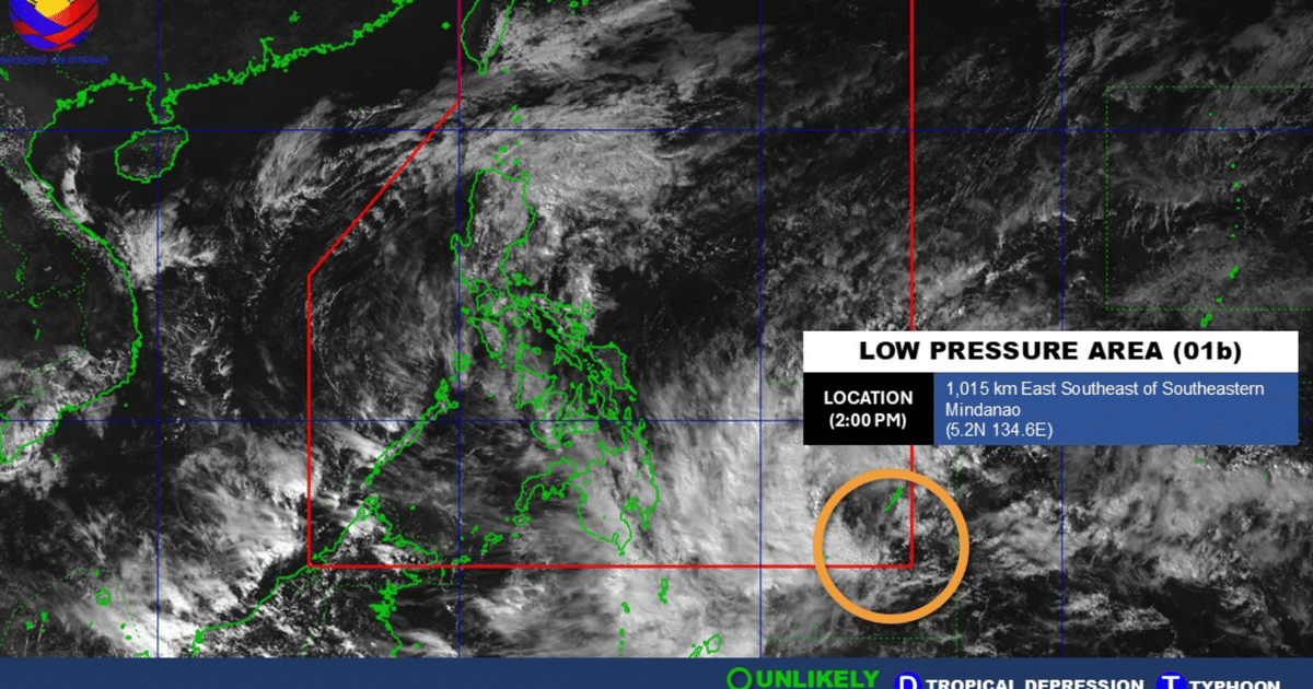
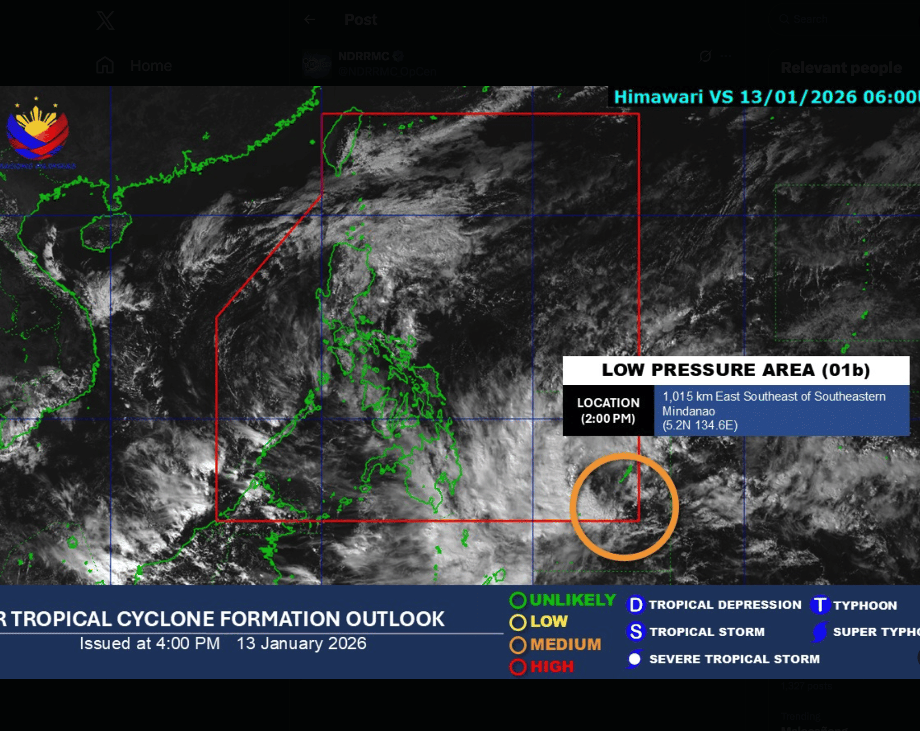
- LPA 01b, the first potential disturbance of 2026, could become Tropical Depression Ada by Thursday.
- PAGASA assessed a 'medium' probability of tropical depression formation within 24 hours.
- Southwest Monsoon enhanced by LPAs may bring 100-200 mm rainfall to Metro Manila until Tuesday.
- Quezon City DRRMO deployed rescue boats at Brgy. Sto. Domingo and Maria Clara Street.
Two Disturbances Track East of Luzon
The Philippine Atmospheric, Geophysical and Astronomical Services Administration (PAGASA) is monitoring two low-pressure areas (LPAs) inside the Philippine Area of Responsibility, both with a medium chance of developing into a tropical depression within the next 24 hours. As of 3 p.m. Monday, the first LPA was located 1,220 kilometers east of Southeastern Luzon, while the second was observed 405 kilometers east of Calayan, Cagayan. The trough of the second LPA is expected to affect weather conditions in Cagayan Valley.eanwhile, satellite imagery from the Himawari VS satellite on Tuesday identified a separate disturbance, LPA 01b, positioned about 1,015 kilometers east-southeast of southeastern Mindanao at coordinates 5°N, 134.6°E.
First Potential Storm of 2026 Could Be Named Ada
The National Disaster Risk Reduction and Management Council (NDRRMC) reported that LPA 01b is the first potential weather disturbance of 2026 in the Philippines, a nation prone to typhoons due to its location in the Pacific typhoon belt. If the system intensifies into a tropical depression, it would be named Ada, the first name on PAGASA's annual list. Current forecasts indicate that LPA 01b could evolve into a tropical depression by Thursday, January 15, 2026, at the latest. The 24-hour tropical cyclone formation outlook assessed a medium probability of development, marked in orange on PAGASA's graphic, contrasting with lower risks such as unlikely or low.
Southwest Monsoon Enhanced, Heavy Rainfall Expected
The Southwest Monsoon, locally known as Habagat, is being enhanced by the presence of the LPAs, bringing rain over several parts of the country. PAGASA earlier stated that Metro Manila and several provinces are expected to experience 100 to 200 millimeters of rainfall due to the enhanced Habagat until Tuesday. Affected areas include Metro Manila, CALABARZON, Zambales, Bataan, Pampanga, Bulacan, and Occidental Mindoro. The weather conditions of Ilocos Region, Benguet, Tarlac, Marinduque, and Oriental Mindoro will also be affected, potentially triggering flash floods and landslides.
Widespread Rains and Thunderstorms Across Visayas and Mindanao
Cloudy skies with scattered rains and thunderstorms will be observed over Visayas, the rest of Luzon, Zamboanga Peninsula, Caraga, Northern Mindanao, and Davao Region due to the Habagat. The rest of Mindanao will see partly cloudy to cloudy skies with isolated rain showers or thunderstorms, which may also trigger flash floods and landslides. State meteorologists said winds will be moderate to strong, while coastal waters will be moderate to rough in the western section of Luzon. The eastern section of Northern Luzon and the rest of Luzon and Visayas will experience moderate wind and coastal water conditions.
Quezon City Deploys Rescue Boats as Precaution
Due to the continuous rains brought by the Habagat, the Quezon City Disaster Risk Reduction Management Office deployed rescue boats at the intersection of Barangay Sto. Domingo and Maria Clara Street. This preemptive measure aims to prepare for possible flooding in the area. The Philippines experiences an average of 20 typhoons annually, often causing significant damage through flooding and strong winds. The current LPAs, while still in early stages, underscore the country's vulnerability to weather disturbances, especially as the first potential storm of the year approaches.
The bottom line
- Two LPAs are inside PAR with medium chance of becoming tropical depressions within 24 hours.
- LPA 01b is the first potential weather disturbance of 2026 and could be named Ada.
- Enhanced Southwest Monsoon is causing heavy rainfall, with 100-200 mm expected in Metro Manila.
- Flood and landslide risks are elevated across Luzon, Visayas, and parts of Mindanao.
- Quezon City has deployed rescue boats as a precautionary measure.
- The Philippines averages 20 typhoons per year, highlighting its exposure to such events.


No Earthquakes Recorded Near Montreal in Past 24 Hours as Seismic Activity Remains Low

Raptors Face Elimination as Barnes and Ingram Injuries Mount

Apple May Split iPhone 18 Launch Across Two Events as Premium Models and Foldable Debut in Fall
