France Braces for Weeks of Unsettled Weather, Flooding Risks
A clash of warm Mediterranean air and Atlantic cold fronts fuels a forecast of heavy rain, violent storms, and potential tornadoes.
CANADA —
Key facts
- France faces a potentially turbulent weather period over the next two weeks.
- A clash between warm Mediterranean air and cold Atlantic air is creating atmospheric instability.
- Heavy rainfall, violent thunderstorms, and a heightened risk of flooding are forecast.
- Episodes of hail and even tornadoes are considered possible.
- Dry soils exacerbate flood risks by promoting rapid surface runoff.
- Melting snow in mountain ranges could further swell rivers.
- Temperatures are expected to drop below seasonal norms in some regions.
Unstable Skies Loom Over France
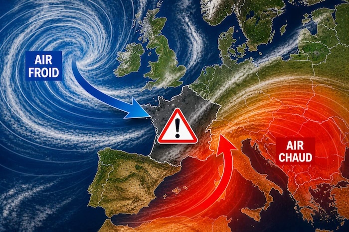
France is bracing for a sustained period of volatile weather, with forecasters warning of a potentially turbulent two weeks ahead. The instability is driven by a significant atmospheric configuration across Western Europe, where vast Atlantic depressions are pushing cold air towards France. This cold air is meeting a surge of much warmer air from Spain and the Mediterranean, creating a volatile mix. The clash of these air masses is generating a zone of intense instability over the country. When cold air descends above a warm, humid layer, the atmosphere becomes highly dynamic, leading to the rapid development of towering convective clouds. This volatile situation is expected to persist for several days, potentially extending for a significant portion of the next fortnight. The most concerning aspect is the prospect of continuous disturbances with no substantial periods of calm, a scenario that raises alarms for both infrastructure and daily life.
The Threat of Deluges and Violent Storms
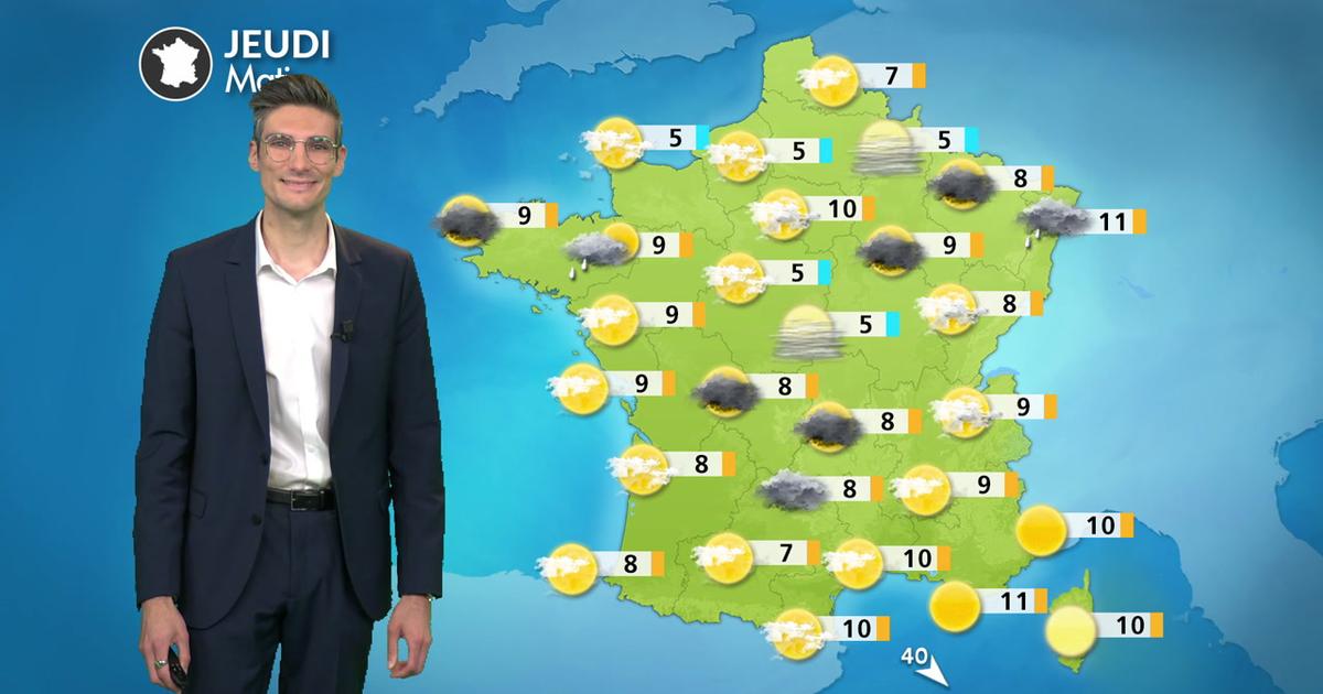
The primary concern is the increased likelihood of heavy rainfall and violent thunderstorms. The dynamic atmospheric conditions are conducive to intense convective precipitation, with significant rainfall totals anticipated in many areas. The southeast, in particular, faces a risk of localized, intense downpours, potentially leading to flash floods. Forecasters are also highlighting the possibility of severe weather phenomena, including episodes of hail and, in the most extreme scenarios, even tornadoes. The risk of hail is particularly noted for the Southwest, Centre, and East of the country, where thermal contrasts are expected to be most pronounced. This forecast marks a stark contrast to April, which was characterized by dry conditions. The shift to a wetter pattern at the beginning of May, however, brings its own set of challenges, especially given the state of the soil across many French regions.
Amplified Flood Risks Due to Dry Ground and Snowmelt
A paradoxical situation is emerging regarding flood risks. After weeks of dryness, many French soils are suffering from a significant water deficit. When intense rain falls rapidly on parched earth, water struggles to penetrate the ground, leading to rapid surface runoff. This phenomenon channels water quickly into rivers, valleys, and urban areas, dramatically increasing the risk of sudden floods and flash inundations. The problem is compounded by the substantial snow reserves still held in mountain ranges like the Alps and the Pyrenees following a wet and snowy winter. As temperatures rise and rain persists, snowmelt in these elevated regions is expected to accelerate. This additional water volume will further contribute to already swollen rivers, creating a heightened risk of overflow and flooding, especially in historically vulnerable sectors.
A Shift in Seasonal Norms
The current weather pattern signifies a notable shift from the exceptionally mild conditions experienced in April. While mornings may still hold some warmth, daytime temperatures are predicted to decrease, falling below seasonal averages in many areas. The Alsace plain, however, is expected to remain relatively mild, with temperatures reaching up to 21°C in Strasbourg. Regions closer to the English Channel, such as Brittany, are forecast to experience more clear spells, though morning fogs are anticipated. The overall trend points towards a cooler, wetter start to May, with a northerly wind shift expected to bring a refreshing, albeit potentially disruptive, change. This period of instability is linked to a 'goutte froide,' or cold drop, an isolated pool of cold air at high altitude that is stagnating over France. Such phenomena are known for generating unpredictable and often severe weather events.
Long-Term Outlook and Lingering Concerns
The prospect of prolonged unsettled weather raises questions about a potential shift towards a more stable, drier climate. While the current rainfall offers some relief from surface drought, the intensity and frequency of the predicted storms are a cause for concern. As the Saints of Ice (May 11, 12, and 13) approach, an annual worry about late frosts resurfaces, though the immediate forecast emphasizes rain and storms rather than freezing temperatures. The coming days will require close monitoring, particularly in areas with a history of severe flooding. The confluence of atmospheric conditions, soil saturation, and mountain snowmelt presents a complex and potentially dangerous meteorological scenario for France.
The bottom line
- France is entering a two-week period of highly unstable weather, characterized by the collision of warm and cold air masses.
- Heavy rainfall and violent thunderstorms are expected, with risks of hail and tornadoes.
- Dry soil conditions combined with accelerated snowmelt in mountains significantly increase the likelihood of flash floods.
- Temperatures are forecast to dip below seasonal norms in many parts of the country.
- The persistent nature of the disturbances, with little expected respite, is a primary concern for authorities and residents.
- The weather pattern is driven by a stagnant 'goutte froide' (cold drop) over France.


Mavericks Hire Masai Ujiri as President, Charging Him to Rebuild After Dončić Trade Fallout

Mark Carney Appoints Louise Arbour as Canada's Next Governor General

British Columbia Smashes Temperature Records Amidst Unseasonable May Heat
