Hong Kong Observatory warns of hail as third cold front in 11 days approaches
Amber rainstorm warning lasted 3½ hours on Sunday; former assistant director says May cold fronts are normal but El Niño will bring extreme heat later this year.

HONG KONG —
Key facts
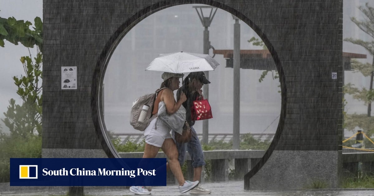
- Amber rainstorm warning issued at 2:20pm and cancelled at 5:50pm on Sunday.
- More than 30mm of rainfall recorded in many parts of Hong Kong.
- Hail warning issued about 40 minutes after the rainstorm signal.
- Third cold front since April 23 set to arrive Sunday night.
- Temperatures expected to drop to 21°C on Monday.
- Former Observatory assistant director Leung Wing-mo said cold fronts in May are climatologically normal.
- Leung warned that developing El Niño will drive temperatures significantly above average in latter half of 2025.
Stormy Sunday triggers amber alert and hail warning
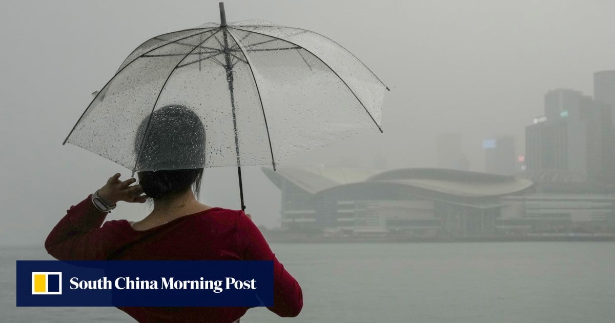
The Hong Kong Observatory issued an amber rainstorm warning at 2:20pm on Sunday, as thundery showers swept across the territory. The signal remained in effect for three and a half hours, finally cancelled at 5:50pm. During that period, many parts of Hong Kong received more than 30mm of rainfall. About 40 minutes after the amber alert, the Observatory also warned that hail could affect the city. “Though the rainstorm warning has been cancelled, people should stay alert to the danger that may be brought about by river flooding,” the forecaster said.
Third cold front in 11 days arrives Sunday night
Despite the solar term Lixia — the Start of Summer in the Chinese calendar — arriving on Tuesday, Hong Kong is bracing for its third cold front since April 23. The latest front is expected to reach the city on Sunday night. Data shows that three cold fronts have crossed Hong Kong’s coast in just 11 days, an unprecedented frequency in the past decade. While cold fronts in May have occurred before — such as on May 11 last year, when temperatures dropped to 21°C — this rapid succession is unusual. Temperatures are forecast to drop to 21°C on Monday, then rebound to 23–24°C. Former Observatory assistant director Leung Wing-mo said this front is mild and unlikely to push temperatures below 20°C.
Leung Wing-mo explains May cold fronts and El Niño outlook
Leung Wing-mo, a former assistant director of the Hong Kong Observatory, noted that cold fronts in May are climatologically normal. He explained that high-pressure systems over North China can push cold air southward even in late spring. When that cold air clashes with the developing summer monsoon over the South China Sea, it often triggers heavy rain, thunderstorms, and even hail. The intensity varies, but the pattern is not out of the ordinary, he said. As for why the weather remains cool ahead of Lixia, Leung pointed out that El Niño has yet to fully mature. Once it does, warmer sea surface temperatures will drive atmospheric warming, bringing significantly above-normal heat to Hong Kong in the latter half of this year.
Midweek reprieve as upper-air disturbances depart
The Observatory said that showers are expected to ease off over the coast of southern China by midweek, when upper-air disturbances move away. However, Hongkongers should expect mainly cloudy skies accompanied by occasional showers and thunderstorms in the next two days. Under the influence of the northeast monsoon and localized upper-air disturbances, the weather is likely to remain slightly cooler over Guangdong province for the next couple of days. The amber rainstorm warning on Sunday was the most recent in a series of severe weather events that have kept the territory on alert.
Unprecedented cluster of cold fronts raises questions
The rapid succession of three cold fronts in 11 days is unprecedented in the past decade, according to available data. While each individual front may be mild, their clustering has kept temperatures below seasonal norms well into May. Leung noted that cold fronts can reach Hong Kong in May and June due to high-pressure systems over North China. The lingering northern air colliding with the summer monsoon often produces severe weather, including the hail and thunderstorms witnessed on Sunday. The Observatory’s warnings have underscored the volatility of the transition period between spring and summer.
El Niño expected to drive extreme heat later this year
Leung warned that the developing El Niño is expected to drive temperatures significantly above average in the latter half of the year. Once fully developed, warmer sea surface temperatures will fuel atmospheric warming. This outlook contrasts sharply with the current cool spell. The contrast between the unseasonably cool spring and the anticipated extreme summer heat highlights the growing variability in Hong Kong’s weather patterns. Residents are advised to stay alert to both the immediate hazards of thunderstorms and hail, and the longer-term risk of heatwaves as El Niño strengthens.
Forecast: cooler Monday then gradual warming
The cold front arriving Sunday night will bring temperatures down to 21°C on Monday, with mainly cloudy skies and occasional showers. By midweek, the weather is expected to stabilize as upper-air disturbances depart. Temperatures will rebound to 23–24°C, but the overall pattern remains unsettled. The Observatory continues to monitor the situation, particularly the potential for further thundery developments. The coming days will offer a brief respite before the longer-term warming trend associated with El Niño takes hold.
The bottom line
- Hong Kong experienced its third cold front in 11 days, an unprecedented frequency in the past decade.
- An amber rainstorm warning lasted 3½ hours on Sunday, with hail also warned.
- Former Observatory assistant director Leung Wing-mo said May cold fronts are normal but El Niño will bring extreme heat later in 2025.
- Temperatures dropped to 21°C on Monday, with midweek improvement expected.
- The rapid succession of cold fronts is unusual but each front individually is mild.
- El Niño's development is expected to drive significantly above-average temperatures in the latter half of the year.


Hong Kong Braces for 9-Degree Temperature Drop and Thunderstorms as Cold Front Approaches
Hong Kong Braces for Thunderstorms as Cold Front Brings Temperatures Down to 21°C
Coleman Wong overcomes Bu Yunchaokete to set up Jiujiang semi-final against Sun Fajing
