Hong Kong Braces for Third Cold Front in 11 Days as Summer Solar Term Approaches
The Hong Kong Observatory warns of thunderstorms and a temperature drop to 21°C on Monday, while meteorologists note the unusual frequency of late-spring cold fronts.

SINGAPORE —
Key facts
- Three cold fronts have swept across Hong Kong's coastline within 11 days since April 23.
- The latest cold front is expected to arrive on the evening of May 3, bringing temperatures down to around 21°C on May 4.
- The Hong Kong Observatory issued a warning at 12:20 pm on May 3 about a thunderstorm area affecting inland Guangdong and approaching Hong Kong within two to three hours.
- Former Observatory assistant director Leung Wing-mo described the incoming front as relatively mild, unlikely to push readings below 20°C.
- Lixia, the traditional Chinese solar term marking the start of summer, falls on May 5.
- Leung noted that the anticipated El Niño phenomenon has yet to fully develop, but once established, it could bring significantly above-average heat in the latter half of 2026.
- A similar cold front brought temperatures to 21°C on May 11 last year, but such a rapid succession has not been recorded in the past decade.
Cold Front Approaches as Hong Kong Nears Summer Solar Term
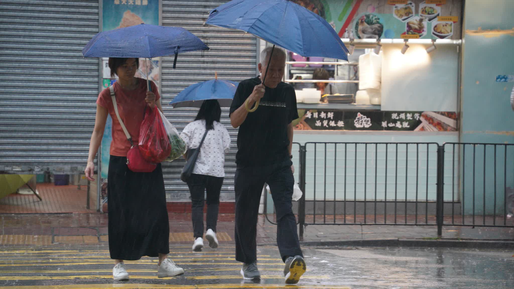
Hong Kong is set to experience its third cold front in less than a fortnight, even as the city approaches Lixia — the traditional Chinese solar term marking the start of summer on 5th May. The Hong Kong Observatory said on Saturday that a trough of low pressure over central China is developing into a cold front and will approach the city late on Sunday. The forecaster urged the public to monitor weather changes and check updates before planning outdoor activities.
Thunderstorms and Temperature Drop Expected
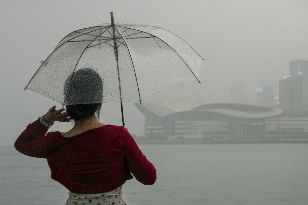
The Observatory stated that locally, there will be sunny intervals on Sunday morning, but showers will increase with squally thunderstorms later in the day, and will be heavier in some areas. Temperatures will drop progressively at night to a minimum of around 21 degrees Celsius (69.8 Fahrenheit) on Monday morning. At 12:20 pm on May 3, the Observatory issued a specific warning that a thunderstorm area associated with the cold front is affecting inland areas of Guangdong and the region west of the Pearl River Estuary, and is expected to gradually approach Hong Kong in the next two to three hours.
Meteorologist Explains Unusual Frequency
Former Hong Kong Observatory assistant director Leung Wing-mo said the latest system is expected to arrive tonight, bringing temperatures down to around 21°C on Monday before rising again to between 23°C and 24°C. He described the incoming front as relatively mild and unlikely to push readings below 20°C. Leung explained that late-spring cold fronts can reach southern China when high-pressure systems over North China drive cooler air southwards. When this residual cold air meets the developing summer monsoon over the South China Sea, it can trigger bouts of heavy rain, thunderstorms and occasionally hail.
Rapid Succession of Cold Fronts Unprecedented in a Decade
Meteorological data indicate that three cold fronts have swept across Hong Kong's coastline within 11 days since 23rd April. Although cold fronts are not unusual in May — temperatures fell to 21°C on 11th May last year — such a rapid succession has not been recorded in the past decade. Despite the unusual frequency this year, Leung stressed that such systems in May remain climatologically normal.
El Niño Development Could Bring Summer Heat
Addressing the cooler-than-expected conditions ahead of Lixia, Leung noted that the anticipated El Niño phenomenon has yet to fully develop. Once established, rising sea surface temperatures are expected to fuel atmospheric warming, potentially bringing significantly above-average heat to Hong Kong in the latter half of 2026. This suggests that the current cool spell may be a temporary anomaly before a hotter summer.
The bottom line
- Hong Kong is experiencing its third cold front in 11 days, an unusually rapid succession not seen in the past decade.
- Temperatures are expected to drop to around 21°C on Monday, with thunderstorms and heavy rain in some areas.
- The cold front is associated with a trough of low pressure developing into a cold front over central China.
- Former Observatory assistant director Leung Wing-mo says the front is mild and climatologically normal for late spring.
- The El Niño phenomenon has not yet fully developed, but could lead to above-average heat in Hong Kong later in 2026.


Metal Beam Crashes Through Yishun HDB Roof During Dismantling Works; No Injuries

Jason Holder's Four-Wicket Haul Propels Gujarat Titans to Four-Wicket Win Over Punjab Kings
Singapore Airlines Delays New First and Business Class Seats to 2027 Amid Supply Chain Woes