Cape Town Braces for Strong Winds and Evening Showers as Cut-Off Low Looms
While the Mother City enjoys relatively clear skies on Thursday, a powerful cold front threatens to bring flooding and damaging gusts to the Western Cape.

SOUTH AFRICA —
Key facts
- Cape Town's daytime high on Thursday, 1 May 2026, is forecast at 18°C with a low of 14°C.
- North-northwesterly winds of 30 kph are expected, with gusts up to 61 kph.
- Cloud cover will reach 84% during the day and 98% in the evening.
- Probability of precipitation is 25% during the day, rising to 59% in the evening, with a 12% chance of thunderstorms.
- An estimated 0.6 mm of rain is expected overnight.
- A cut-off low weather system is forecast to bring flooding and strong winds to the Cape region.
- School closures have been ordered across parts of the Western Cape due to the storm warning.
A Tale of Two Forecasts: Sunshine by Day, Storm by Night
Cape Town is set for a day of stark contrasts on Thursday, 1 May 2026, as mostly cloudy skies give way to strong winds and a chance of evening showers, according to the latest weather forecasts. While the city will enjoy relatively mild temperatures—peaking at 18°C and dropping to 14°C overnight—the real story lies in the wind and the looming threat of a cut-off low pressure system. Southeasterly winds of 22 kph were initially predicted, but later updates indicate a shift to north-northwesterly winds at 30 kph, with gusts reaching up to 61 kph. The UV index will remain low at 1, with thick cloud cover limiting sunshine throughout the day.
Cut-Off Low Triggers Flood and Wind Alerts
Meteorologists have issued a weather alert for an intense cut-off low that is expected to bring flooding and strong winds to the Cape region. The system, which develops when a cold front becomes detached from the main westerly flow, can stall and produce prolonged heavy rain. Residents in low-lying areas have been urged to take precautions as the storm approaches. School closures have been ordered across parts of the Western Cape as a precautionary measure, with authorities citing the risk of dangerous travel conditions and potential damage to infrastructure. The South African Weather Service has warned that the cut-off low could cause localised flooding, especially in areas already saturated by recent rains.
Contrasting Conditions Across South Africa
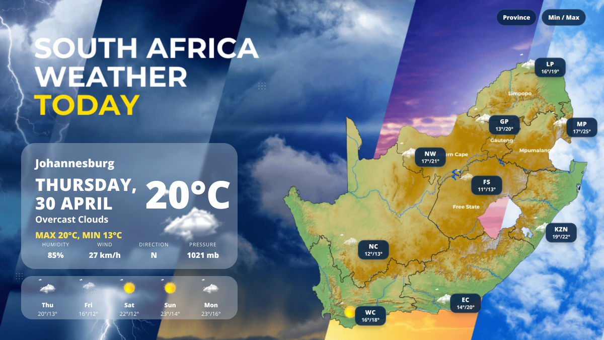
While Cape Town faces the brunt of the storm, other parts of the country will experience markedly different weather. Johannesburg is forecast to see a cold day with a high of 16°C and an overnight low of 4°C, under overcast skies and southwesterly winds gusting to 41 kph. Pretoria will be warmer, reaching 20°C, but will also cool sharply to 5°C overnight. In contrast, the northern and eastern interior remain mostly cloudy, with significant rainfall developing over the Free State and Northern Cape. Moderate to heavy rain is expected to persist throughout the day in those provinces, with possible localised flooding. The national average temperature stands at 17°C, with Mpumalanga recording the warmest conditions at 25°C.
Precision Forecasts: Numbers That Matter
For Cape Town, the probability of precipitation stands at 25% during the day, increasing sharply to 59% in the evening, with a 12% chance of thunderstorms. An estimated 0.6 mm of rain is expected overnight. Cloud cover will build from 84% during the day to 98% in the evening, ensuring a mostly overcast night. Wind speeds are a key concern: north-northwesterly winds of 30 kph will gust up to 61 kph during the day, easing slightly to 56 kph overnight. The combination of strong winds and saturated ground raises the risk of fallen trees and power outages. Sunrise is at 7:21 am and sunset at 6:05 pm, giving residents a relatively short window of daylight to prepare.
Public Response and Precautionary Measures
Authorities have urged Cape Town residents to take precautions as the cold front approaches. The city's disaster management centre is on standby, and residents in flood-prone areas have been advised to move valuables to higher ground and avoid unnecessary travel during peak wind gusts. The storm warning has also prompted the closure of several schools across the Western Cape, with officials citing safety concerns for students and staff. In the Free State and Northern Cape, drivers have been advised to reduce speed and allow extra travel time due to ongoing rain and potential flooding. In Gauteng, strong northerly winds gusting up to 27 kph will contribute to cool morning conditions, though no rain is anticipated.
Outlook: What Comes Next
The cut-off low is expected to linger over the Cape region through the weekend, with the potential for additional rainfall and gusty winds. Forecasters are monitoring the system closely, as its slow movement could prolong the threat of flooding. Residents are advised to stay updated through official channels and to heed any evacuation orders if issued. Meanwhile, other parts of the country will see a gradual return to more typical autumn conditions. Johannesburg and Pretoria can expect clear skies and chilly nights, while coastal areas like Durban will remain overcast but mild. The contrast between the storm-battered Cape and the relatively calm interior underscores the diversity of South Africa's weather patterns.
A City on Edge: The Stakes of the Storm
For Cape Town, a city no stranger to extreme weather, the approaching cut-off low represents a test of preparedness. The combination of strong winds, heavy rain, and the potential for flooding poses risks to both life and property. The decision to close schools reflects a cautious approach, but the full impact will only become clear as the system moves through. As the evening progresses and the probability of rain rises, residents will be watching the skies with a mixture of hope and apprehension. The storm serves as a reminder of the power of nature and the importance of heeding early warnings.
The bottom line
- Cape Town faces strong north-northwesterly winds gusting to 61 kph and a 59% chance of evening rain on Thursday, 1 May 2026.
- An intense cut-off low pressure system is forecast to bring flooding and damaging winds to the Western Cape, prompting school closures.
- Johannesburg will see a cold day with a high of 16°C and an overnight low of 4°C, while Pretoria reaches 20°C but drops to 5°C.
- The Free State and Northern Cape are under moderate to heavy rain, with possible localised flooding and travel disruptions.
- Mpumalanga records the warmest conditions in the country at 25°C, while the central interior experiences the coolest and wettest weather.
- Residents in affected areas are urged to take precautions, including avoiding travel during peak winds and moving valuables to higher ground.


OpenAI Shifts ChatGPT Ads to Cost-Per-Click After Launch Pricing Collapses

Jet fuel prices surge over 100% at South African airports, airlines add surcharges
LeBron James Faces Biggest Underdog Test of 23-Year Career as Lakers Enter Thunder Series as 15.5-Point Outsiders
