Met Éireann Warns of Thunderstorms as Bank Holiday Weekend Brings Mixed Weather
Heavy showers and potential thunderstorms are forecast for southern Ireland, while drier conditions are expected to return next week.
IRELAND —
Key facts
- Met Éireann has issued a thunderstorm warning for parts of Ireland.
- Heavy showers are expected, particularly in Munster and the southern half of the country.
- Temperatures will range from 2 to 16 degrees Celsius over the weekend.
- Bank Holiday Monday will be drier with some sunny spells.
- Tuesday will see patchy rain clearing to the southeast, followed by bright spells.
- Wednesday is likely to be dry in most areas, with rain possible in Ulster and northeast Leinster.
Thunderstorm Warning and Immediate Stakes
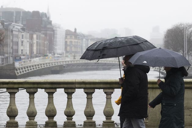
Met Éireann, the Irish National Meteorological Service, has warned of thunderstorms and heavy showers as the Bank Holiday weekend unfolds. The warning comes as a mix of rain and sunny spells is expected across the country, with the most intense downpours predicted for the southern half of Ireland. Meteorologist Gerry Murphy stated that while the morning will bring cloud and some sunshine, heavier showers will develop in the afternoon, particularly in parts of Munster. These storms could bring lightning and localised flooding, posing risks to outdoor activities and travel.
Forecast Details for the Weekend
According to Met Éireann, Saturday will see a fair amount of cloud with patches of mist and showers, especially in Ulster and the midlands. As the day progresses, heavier showers will develop over the southern half of the country, with the heaviest in Munster. Temperatures will range from 11 to 16 degrees Celsius, with light to moderate northerly breezes. Sunday night will see showers easing, becoming more isolated, with mist and fog possible. Temperatures will drop to between 4 and 9 degrees Celsius. Bank Holiday Monday is expected to be drier, with some mist or fog at first and light showers, but turning bright and sunny at times, with temperatures between 11 and 15 degrees Celsius.
Early Next Week: Drier Weather Returns
The dry weather is set to make a comeback next week, according to the national forecaster. Tuesday will be mostly cloudy in the morning, with patchy light rain or drizzle in the southeast. However, any precipitation will clear to the southeast through the afternoon and evening, followed by bright and sunny spells from the northwest. Temperatures will range between 10 and 13 degrees Celsius, with the highest values in the south. Wednesday is likely to be dry in most parts of the country, with sunny and bright spells. Ulster and northeast Leinster may see some rain, but overall conditions will be more settled.
Meteorological Context and Data Sources
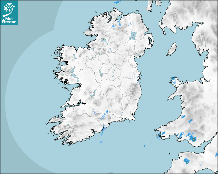
Met Éireann's forecasts are based on data from Numerical Weather Prediction models, including the HARMONIE-AROME and the European Centre for Medium-range Weather Forecasts (ECMWF) models. The rainfall radar, updated every five minutes, shows live precipitation and accumulations over the last 90 minutes. Lightning strikes, when they occur, are displayed as crosses that change colour over time. The forecasts include temperature, wind speed and direction, and mean sea level pressure, all derived from model outputs. The weather icons for midday and midnight are manually produced by forecasters to reflect the predicted major weather type.
Broader Climate Trends: Europe Warming Rapidly
The weather patterns come against the backdrop of a warming climate. indicates that Europe is the fastest-warming region, warming at twice the global average. This trend may influence the frequency and intensity of extreme weather events, including thunderstorms and heavy rainfall. Met Éireann's data and services are crucial for monitoring these changes and providing timely warnings to the public. The national meteorological service continues to refine its models and forecasts to better predict and communicate weather risks.
Outlook and Public Advisory
As the Bank Holiday weekend progresses, residents and visitors are advised to stay updated on the latest forecasts and heed any warnings issued by Met Éireann. The thunderstorm warning highlights the potential for sudden, intense downpours that could disrupt travel and outdoor plans. Looking ahead, the return of drier weather next week will provide some relief, but the unsettled conditions underscore the importance of preparedness. Met Éireann's continuous monitoring and forecasting efforts remain essential for public safety and informed decision-making.
The bottom line
- Met Éireann has issued a thunderstorm warning for southern Ireland, with heavy showers expected in Munster.
- Bank Holiday Monday will be drier, but Tuesday and Wednesday will see improving conditions.
- Temperatures over the weekend will range from 2 to 16 degrees Celsius.
- Europe is the fastest-warming region, warming twice as fast as the global average.
- Met Éireann uses advanced models from HARMONIE-AROME and ECMWF for its forecasts.
- The public should stay informed and heed warnings for potential thunderstorms and flooding.


U.S. Launches Project Freedom to Guide Stranded Ships Through Strait of Hormuz as Iran Strikes UAE

Sierra Nevada Braces for 4 Feet of Snow as Late-Season Storm Threatens Travel

NATO Chief Rutte Says Europeans Have 'Gotten the Message' as Trump Threatens Punishment Over Iran War Support
