Texas invests $4 million in flood warning system after 2025 Hill Country disaster killed over 130
University of Texas at Arlington and Rice University join forces to build a predictive radar-based network that forecasts flood depths before waters rise.

UNITED STATES —
Key facts
- Governor Greg Abbott granted $4 million to UT Arlington and Rice University for a new flood warning system.
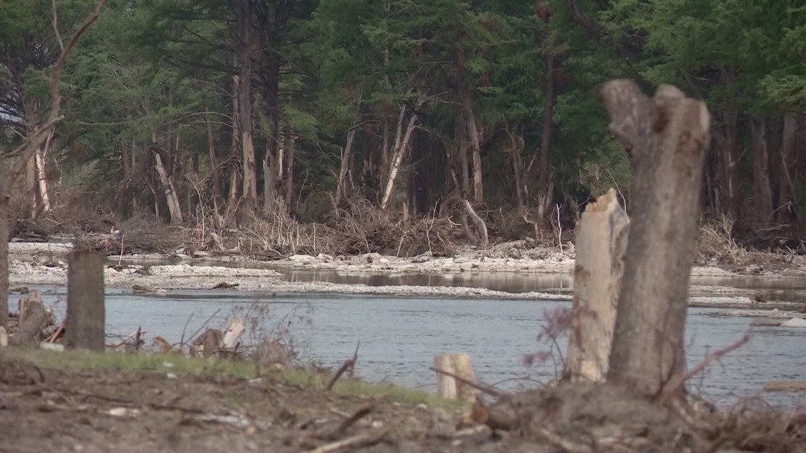
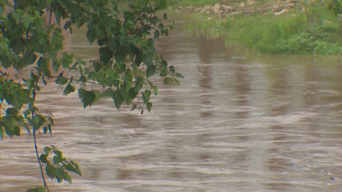
- The 2025 Texas Hill Country flooding killed over 130 people.
- UT Arlington's Water Engineering Research Center (WERC) leads the project.
- Rice University's Severe Storm Prediction, Education and Evaluation from Disasters (SSPEED) center collaborates.
- The system uses radar-derived rainfall data to predict flood water depths in specific locations.
- Researchers aim to create a comprehensive flood plain map for a state-wide warning platform.
- The project builds on decades of storm surge and flood modeling work in Houston and along the Gulf Coast.
A deadly reckoning spurs action
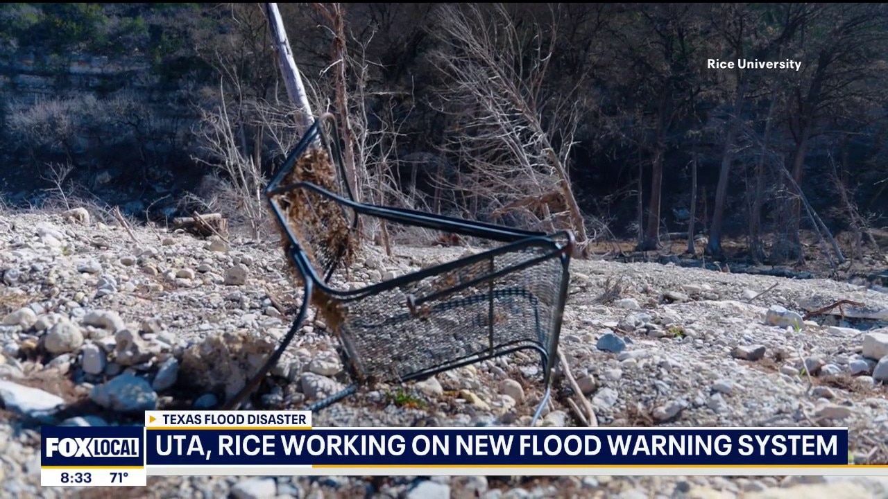
More than 130 people died in the catastrophic 2025 flooding that swept through the Texas Hill Country, a toll that has galvanized state officials and researchers into building a radically earlier warning system. Governor Greg Abbott has allocated $4 million to the University of Texas at Arlington and Rice University to develop a real-time flood alert network designed to give residents and emergency managers extra minutes — even hours — before waters reach critical levels. “The number one priority of our state is the safety of our fellow Texans,” Abbott said in a statement announcing the grant. “This grant will provide critical funding to enhance emergency alert systems.” The governor thanked UT Arlington for working to implement improved weather monitoring systems that can deliver accurate emergency warnings.
From research to real-time action
The new system will be built by UT Arlington's Water Engineering Research Center (WERC) in close partnership with Rice University's Severe Storm Prediction, Education and Evaluation from Disasters (SSPEED) center. Rather than relying on sirens or text alerts that sound only after flooding has begun, the network will use radar-derived rainfall data to forecast flood water depths at precise locations. Emergency officials will receive predictions before flood waters become dangerous, enabling proactive evacuations and road closures. “Early warning doesn’t start with a siren—it starts with science,” said Dr. Bedient, a researcher at Rice. “By combining radar rainfall, stream measurements, and predictive modeling, we can forecast how deep the water will be and where it will go, giving communities the lead time they need to make life-saving decisions.”
Two decades of coastal expertise applied inland
UT Arlington and Rice have already spent decades developing advanced storm surge and flood modeling protections for Houston and the Gulf Coast. The Hill Country project marks a shift inland, applying that expertise to the region's flash-flood-prone terrain. WERC will deploy high-resolution, Texas-focused monitoring to deliver faster and more precise warnings in flood-prone areas, while the SSPEED center contributes storm prediction, flood modeling, and emergency response planning. “This investment allows us to move from research to real-time action,” said Nick Fang, the Robert S. Gooch Endowed Professor and director of WERC. “By combining advanced forecasting, high-resolution weather monitoring, and proven flood modeling techniques, we can provide communities with faster, more accurate warnings that help protect lives and property.”
Building a statewide flood plain map
A central goal of the project is to create a comprehensive flood plain map that will support the operation of a state-wide warning platform. The map will integrate radar rainfall data, stream measurements, and predictive models to show where water is likely to accumulate and how deep it will become. Researchers will also work with state agencies to refine communication protocols for severe weather incidents, ensuring that warnings are clear and actionable. The collaboration aims to strengthen ties among state agencies, local communities, and regional water authorities. By coordinating emergency response strategies, officials hope to reduce the confusion and delay that can prove fatal during flash floods.
What comes next for the Hill Country
The $4 million grant will fund the development and initial deployment of the system, but researchers emphasize that the work is just beginning. The system must be tested, calibrated, and integrated with existing emergency alert infrastructure. If successful, it could serve as a model for other flood-prone regions in Texas and beyond. “Together, we will work to protect Texans and deliver a safer future for all,” Abbott said. The project's success will be measured not only in minutes of lead time but in lives saved when the next storm hits.
The bottom line
- Texas is investing $4 million in a predictive flood warning system after the 2025 Hill Country floods killed over 130 people.
- The system uses radar rainfall data to forecast flood depths at specific locations, giving earlier warnings than sirens or texts.
- UT Arlington and Rice University are combining decades of coastal flood modeling with new high-resolution monitoring for the Hill Country.
- A comprehensive flood plain map will underpin a state-wide warning platform.
- Researchers will work with state agencies to improve communication protocols for severe weather.


U.S. Navy Shepherds Maersk Ship Through Strait of Hormuz as Iran Strikes UAE

UAE Intercepts Iranian Missiles, Condemns 'Dangerous Escalation' After Drone Strike Injures Three

‘Desert Warrior’ Flops at Box Office After Troubled $150M Saudi Production